


ST Forward Event 06/14
Posted on 05/28/2026

No Standing Water
Posted on 05/26/2026

Kitty Season Tips
Posted on 05/21/2026

LASAN Tolietries Drive through 07/02
Posted on 05/12/2026

Sun Valley Art Camp Starting 07/07
Posted on 04/27/2026

Hansen Dam Run 06/14
Posted on 04/15/2026

Juneteenth 06/19
Posted on 05/03/2026

Community March 06-27
Posted on 05/26/2026This is a friendly reminder to sign up for Senator Caroline Menjivar’s 4th Annual San Fernando Valley Pride March and Festival, in collaboration with Mayor Karen Bass, Somos Familia Valle, and Supervisor Lindsey Horvath on Saturday, June 27, 2026.
This year’s theme, Our Ground to Hold, reflects our commitment to standing together in solidarity with LGBTQ+ communities across the San Fernando Valley and beyond.

Lopez Canyon Environmental Class 06/27
Posted on 04/27/2026

Crossing Guards Needed
Posted on 05/28/2026LADOT is Now Hiring Crossing Guards
LADOT is now accepting applications for new Crossing Guards! Crossing guards keep students safe traveling to and from school and help instill safe, alert walking behaviors in young Angelenos. Our crossing guards are placed at schools throughout the City and educate children on how to navigate a street crossing while increasing their visibility to drivers.
View Previous Posts
Upcoming Meetings & Events
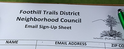
Join Our Mailing List

Sign up here to receive meeting agendas.
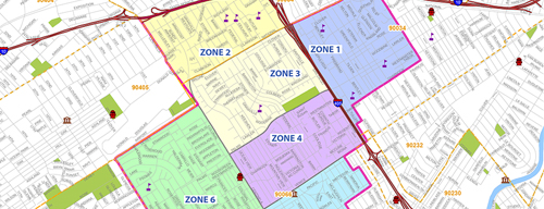
Area Boundaries and Map
Want to know how your Neighborhood Council money is being spent?Click here, then select Foothill Trails District Neighborhood Council from dropdown menu.
For details, then click on "MER" (Monthly Expenditure Report).